
Map: Search Pima County zip codes to see areas of high distress, DCS calls
"Fixing our foster care crisis” was made possible through major funding from the Community Foundation for Southern Arizona and additional support from the University of Southern California Annenberg Center's Fund for Journalism on Child Well-being.
Other stories in the Part 1 series include:
Part 1: Arizona Daily Star special investigation: Fixing our foster care crisis
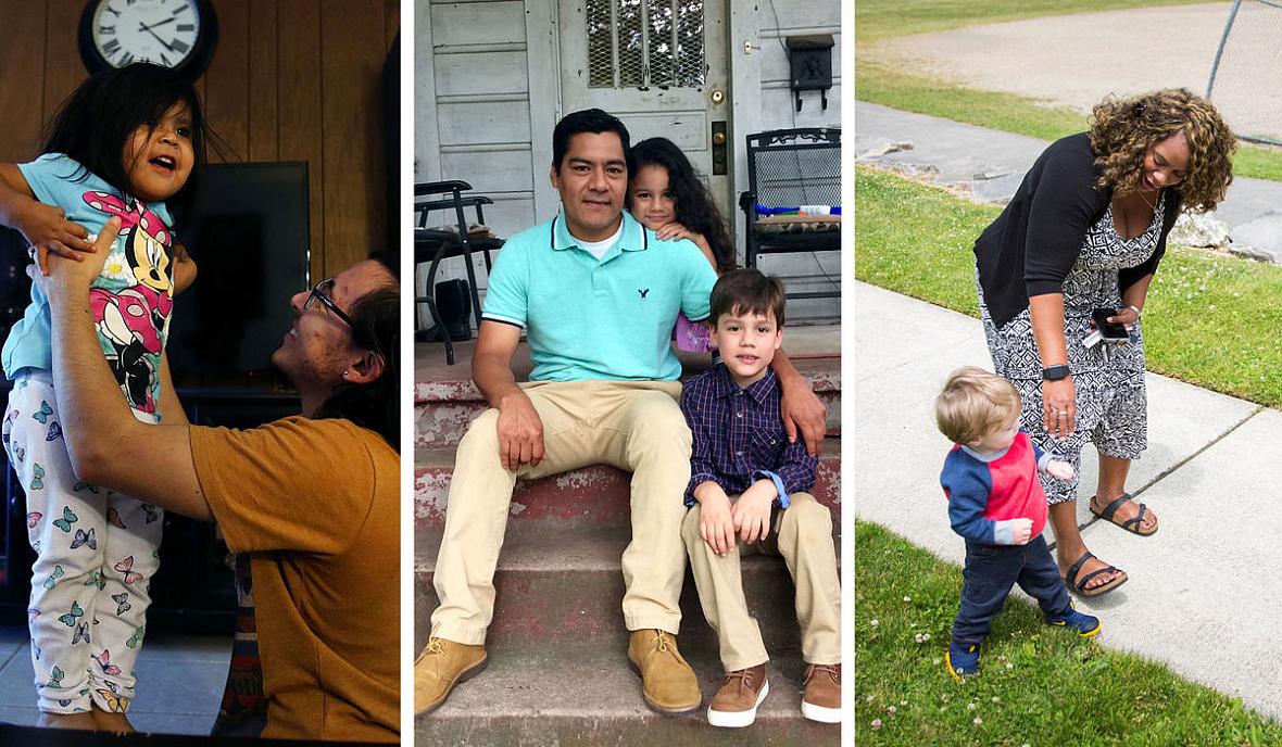
Upfront investments can ward off 'horrible outcomes'
Scramble for social services draining for families already under stress
Negative cycles broken as families learn better ways to cope

The Arizona Department of Child Safety received more than 9,000 reports regarding child safety from Pima County residents during fiscal year 2016. About 2,100 of those reports resulted in children being removed from homes.
State and county data collected by the Arizona Daily Star shows that the Pima County ZIP codes with the highest needs for housing, utility and food assistance are also the areas that receive the most calls to DCS and had the most children removed from their homes.
Map below: Click on a ZIP code to see information about the health of that area. Indicators include poverty rates and calls for assistance, such as food and housing, as well as removal rates and child abuse hotline calls
Reports to Child Safety Department in Pima County ZIP codes
The Arizona Department of Child Safety received more than 9,000 reports regarding child safety from Pima County residents during fiscal year 2016.
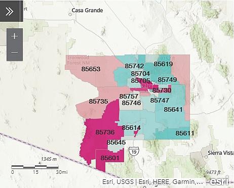
Click on a ZIP code to see information about the health of that area. Indicators include poverty rates and calls for assistance, such as food and housing, as well as removal rates and child abuse hotline calls. Find more information here.
Data and maps can be used to help communities pinpoint areas of greatest need, where resources can be pooled to provide better support for families and children.
National organizations promoting this approach include Casey Family Programs, which released its new community opportunity map site last month.
There’s also Predict-Align-Prevent which was started by Texas pediatric anesthesiologist Dyann Daley.
Poverty is a big indicator, Daley said, but using data on certain violent crimes including domestic violence, aggravated assault and sexual assault, as well as data on runaways, provides greater accuracy for determining where child maltreatment is most likely to occur.
“The purpose of this work is to target resources to make vulnerable communities as safe as they can be and as well-resourced as they can be,” Daley said. “You have to figure out how to work together as a community to create a safer environment for children.”
Map can be accessed by clicking here.
[This story was originally published by the Arizona Daily Star.]